


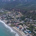


Powerful earthquake offshore of Manabi Province is felt in much of the country
An earthquake measuring 6.3 degrees on the Richter scale, centered 20 miles offshore of Bahia de Caraquez, was felt in much of Ecuador late Friday afternoon. There were four afershocks recorded until midnight, the largest measuring 4.9.
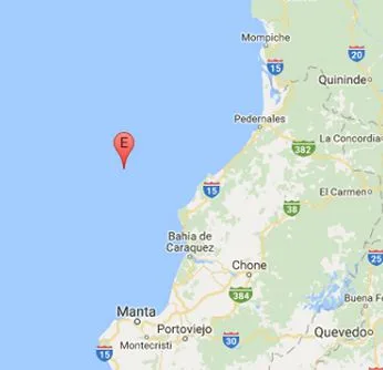
Earthquake location map.
The 6.3 magnitude quake, which struck at 5:30, sent office workers into the streets of Manta and Guayaquil and set off building and car alarms as far away as Quito.
Ecuador’s Geophysical Institute issued a statement shortly after the quake, saying that other seismic activity is possible in the coming days.
The institute’s director, Alexandra Alvarado, said the earthquake occurred near the fault line of the massive 7.8 magnitude April, 16, 2016 earthquake, and was technically an aftershock. “At this point, we believe the earthquake is a release of pressure that has built up over the past year.”
The quake disrupted cell phone and electric service in some coastal areas. Emergency services said that five people were injured in Manabi Province and that four houses collapsed or were severely damaged.
A smaller tremor felt by some in Cuenca just before 6 p.m. was unrelated to the coastal earthquake, according to the Geophysical Institute. The 3.7 magnitude earthquake was was centered about 30 miles east of Cuenca, near Gualaceo.