


Weather forecasters monitor the Pacific Ocean off Ecuador and Peru for signs of El Niño development
By Matthew Cappucci
A developing El Niño is already dramatically influencing Earth’s weather, scrambling precipitation patterns and boosting temperatures higher and higher. Forecasters say it’s only a matter of time before El Niño’s arrival is official, and there is concern it could incite unprecedented extreme weather.
 Scientists don’t yet know how strong this El Niño will become, and its intensity will have big implications for where extreme weather occurs and its severity. But they do know it’s arriving amid the highest ocean temperatures in modern records.
Jennifer Francis, a climate scientist at the Woods Hole Research Center, warned in a recent podcast to “expect chaos,” especially if this El Niño turns out strong.
“We have not had a strong El Niño in conjunction with ocean heat wave in the North Pacific, in conjunction with an Atlantic Ocean [where] the temperatures are almost off the charts,” she said. “So, you know, this combination of factors is really nothing that we’ve seen before. So it’s a real challenge to make any kind of a prediction.”
El Niño is the opposite of La Niña. Together they make up ENSO, or the El Niño-Southern Oscillation. Like a pendulum, Earth swings between the two states every two to seven years. ENSO dominates global circulation patterns, triggering chain-reaction processes that shape weather locally and half a world away.
What’s the latest?
El Niño begins as a rising of water temperatures in the eastern tropical Pacific. This is underway, and it’s the first domino to fall ahead of cascading impacts worldwide.
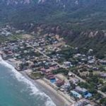
Warming has been especially pronounced off the coast of Peru and Ecuador.

During the1998 El Niño Ecuador’s coast suffered months of flooding and hundreds of millions of dollars in damages.
“The warming off Peru is pretty dramatic and very likely presages a stong El Niño event,” said Gavin Schmidt, a climate scientist at NASA.
Forecasters are also monitoring temperatures in an imaginary rectangle drawn across a broader area of the eastern and central tropical Pacific, known as the Niño 3.4 region. The National Weather Service declares the onset of El Niño when water temperatures are at least 0.9 degrees Fahrenheit (0.5 Celsius) above normal for a three-month period, which could be very soon. Water temperatures there are 1.4 degrees (0.8C) above normal after a rapid ramp-up.
But for El Niño to be considered strong, the Niño 3.4 region must warm to at least 2.7 degrees (1.5C) above normal for an extended stretch. It’s unclear whether waters will warm that much.
“Right now different forecasting methods are giving different forecasts of the magnitude,” Schmidt said, adding that it’s “not obvious to me which method is more reliable in these circumstances.”
Michelle L’Heureux, a forecaster at the National Weather Service’s Climate Prediction Center, agrees that the verdict is out regarding El Niño’s intensity.
While temperatures offshore of Peru and Ecuador are a good first indicator of a burgeoning El Niño, L’Heureux noted that warming events similar to this year’s haven’t always culminated in an oceanwide El Niño, the larger scale of which would spell greater impacts. A 2017 warming of waters off the coast of Peru fell flat when it came to jump-starting any basinwide El Niño. That said, L’Heureux is impressed with just how hot the waters are.
“In our satellite-era record, the only coastal [sea surface temperatures] that seem to exceed the current values we are seeing were during spring of 1998 and 1983 (after the peak of El Niño in 82-83),” she wrote in an email. “So, it’s a little unusual to see it as warm as it is there before an El Nino potentially gets underway.”
An uncertain future
So, what happens next? According to Thomas Smith, a professor in the department of geography and environment at the London School of Economics and Political Science, what’s happening is already defying convention.
“This particular warming is unusual because it’s been around for a couple of months now,” he said in an email. “What usually follows is a weakening of the easterly trade winds in the tropical Pacific. These usually carry sun-warmed waters west toward Indonesia and northeastern Australia. This hasn’t happened yet, and instead we have a situation where the whole of the tropical Pacific is warmer than usual.”
Virtually the entire Atlantic and Indian ocean basins are also running anomalously hot, and worldwide ocean temperatures have spent months setting records.
In forecasting what comes next, Smith says there are two courses of action — relying on forward-looking weather models or on similar past scenarios, known as “analogues,” to determine precedents. That methodology has flaws, though.
“The main problem with both approaches is that the current situation is so far from normal (with ocean temperatures being above previous records for over two months), that both the models and the analogues might not be reliable,” Smith said. “So it’s very difficult to predict what might happen with the El Niño situation this year.”
What the forecasts say
According to Schmidt, computer models are divided on El Niño’s strength. Dynamical models, which take current data and simulate what’s next using knowledge on the physics of the atmosphere, are bullish on a higher-end El Niño.
A stronger El Niño would be very likely to boost global temperatures to a record high.
“At the global level we will likely see a record in 2024 if we start the year with a significant El Niño,” Schmidt said. “Maybe even in 2023 if it ramps up fast enough.”
The planet could even warm so much that it could briefly breach a key climate threshold — a global temperature rise of 1.5 degrees Celsius, or 2.7 degrees Fahrenheit, above preindustrial levels.
But statistical model projections of El Niño, which base simulations on prior observations, are, in Schmidt’s words, “far less bullish” and depict a Niño 3.4 index of only 0.9 degrees (0.5C). Other types of statistical forecasts using analogues split the difference.
“An El Niño event, but nothing huge,” Schmidt said of the latter.
El Niño strength matters, especially in some key regions of the United States. The two strongest El Niño events on record, in the winters of 1982-1983 and 1997-1998, brought well-above-average winter precipitation to California. El Niño is correlated with higher precipitation totals on the West Coast, but that relationship becomes much weaker as the magnitude of an El Niño dwindles.
El Niños also bring drier-than-average conditions to the Ohio Valley and parts of the Midwest; if it’s a strong El Niño, the Pacific Northwest and northern Rockies also trend drier than average. For the Northeast and New England, El Niño winters tend to bring near-average precipitation, but higher temperatures mean more of it falls as rain rather than snow.
According to Climate.gov, Hawaii also experiences drier-than-average conditions from the late fall through early spring. For Alaska, there doesn’t exist a clear precipitation signal, but winters are usually warmer during El Niño years.
When it comes to hurricanes in the Atlantic, El Niño works twofold toward bringing a quieter season. In addition to bolstering wind shear or changing winds with height that can disrupt tropical systems and prevent them from forming, El Niño patterns also deliver broad subsidence, or sinking air. That tends to support a less-active-than-average season.
This year, however, experts say the extreme warmth of the Atlantic, which can fuel storms, may counteract El Niño’s suppressive effects.
_____________________
Credit: Washington Post